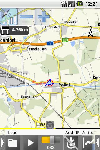
Outdoor orientation with GPS for hiking and biking. Automatic download of OpenStreetMaps (OSM) or from other map sources.Maps and routes can be used offline after…
Android Apps, Android Devices and Android Dev
Outdoor orientation with GPS for hiking and biking. Automatic download of OpenStreetMaps (OSM) or from other map sources.Maps and routes can be used offline after…
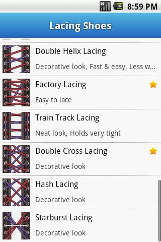
Valentine's day discount! Hurry up! -30%! Get PRO version! How many lacing methods do you know? A lot of people lace their shoes with one…
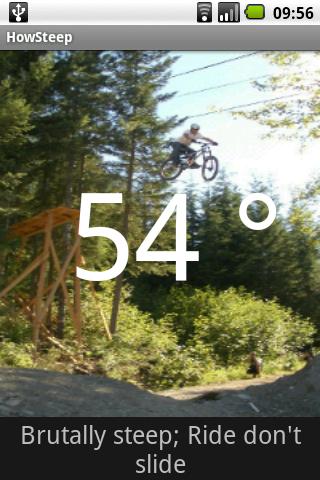
Ever wondered just how steep that slope was? This fun tool will tell you.Options for mountain biking (MTB), ski-ing/snowboarding, avalanche danger and Ice climbing.Boast about…

Outdoor orientation with GPS for hiking and biking. Automatic download of OpenStreetMaps (OSM) and from other map sources. Maps and routes can be used offline…