Cloud RF radio coverage
VHF-UHF radio planning in your pocket. Global terrain coverage accurate to 90m. Internet connection required.
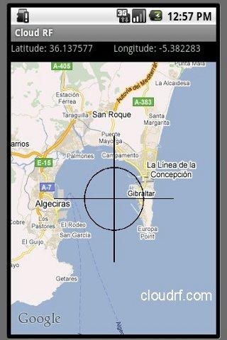
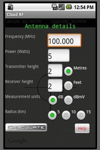
Pan the map to site the antenna. Press MENU to see the apps options, press CENTER to bring up the Antenna input form.
It uses a server at www.cloudrf.com running SPLAT! (Signal Path Loss and Terrain Analysis Tool) supported by SRTM2 elevation data from NASA. This server generates images displaying path loss which are overlaid on Google Maps. The process takes from between 5 seconds for a 5km radius prediction to 25 seconds for the larger 15km variants.
The terrain resolution is accurate to 90m and the effective range of the 'Longley Rice' propagation model is 20MHz to 20GHz.
Disclaimer:
It is your responsibility to verify the accuracy of the results. Cloudrf.com accept no responsibility for any communications related cock ups.
App Specification
- App Name: Cloud RF radio coverage
- Rating: 3.92
- Apk: com.cloudrf.android.test
- Cost: Free
- Developer: http://alexfarrant.co.uk