Theodolite Beta
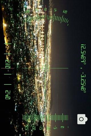
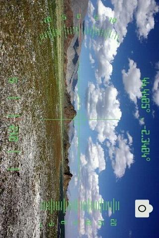
Augmented reality app that uses your phone camera and adds a layer of geographical information such as Compass orientation, GPS position and different phone inclinations.
Never get lost again: You can add your own geographical markers anywhere around you and see them with augmented reality wherever you go. You can also view them on Google Maps in one click.
A triangulation feature helps you calculate distances and you can use your camera at anytime to take pictures including the data layer.
IMPORTANT : This has not been designed for nor tested on any TAB device. DONT download it if for any tab (if you do, dont complain)
-> If you face a crash and leave a comment without reporting the error in any way, theres not much I can do to fix it.
To calibrate your phones G-sensors, try Settings > Display > Calibrate G-sensors
* If you like the app, please rate it :)
** For accurate triangulation when using the GPS, give it a bit of time to get an accurate fix. Wait a few seconds after you move until the figures are stable. When measuring angles, be VERY accurate. A few degrees make a big difference on distant objects. Dont forget that the limitation here is your GPS sensor accuracy, which is about 10 meters. Short distance calculation will therefore be unaccurate.
Height calculation will return a good value on any distance as the inclinaison sensors are much more accurate.
*** When a picture is saved, its path Alias is displayed. It starts with external\. When looking for it, sdcard\DCIM\Camera is a good place to start.
**** Currently working on KML support to interact with Maps and Google Earth
This free app is in Beta mode, please email me report any issues you might face.
App Specification
- App Name: Theodolite Beta
- Rating: 3.97
- Apk: com.theodolite
- Cost: Free
- Developer: